Showing posts with label Where on (Google)Earth?. Show all posts

Saturday, June 02, 2018

Where on Google Earth are the dearly departed?


Callan Bentley of the Mountain Beltway has announced, via Twitter and Facebook, that Ron Schott has passed away. Ron was a long time of internet advocacy for Geology, both through his blog, his twitter account, his gigapan advocacy, and other activities which I haven't kept up with. He was an enthusiastic, good-natured, and helpful geologist, and though I only met him once, in 2009, his passion for explaining the stories of geology at all scales and structures was memorable. And just as fantastic geologic events leave their stories imprinted in the rock record, so too can the traces of Ron's digital Earth Science outreach be found buried and the blogs and feeds of social media. However, like the paleontological records left behind by vanished creatures, these digital fossils serve mostly to remind us of the sense of loss that we have in knowing that we can no longer meet their creator. Rest in Peace, Ron. We miss you.

Wednesday, December 12, 2012

Odd-shaped lakes in Google Earth

I was goofing around in Google Earth this evening, performing an activity that started out as meaningful and quickly degenerated into a Game of "Ooh what's that", when I came across the following:
Note the very strange shoreline on this lake, with numerous straight line borders. The first time I saw this, I thought I was looking at some dams I didn't know about, but I quickly realized that such an interpretation made no sense.

 Instead, what I believe this image is showing is a mosaic from pictures acquired several years apart. One of those years was a wet year, while another must have been after a period of extended drought. As a result, the lake is ~90% full in some of the images, but almost empty in others. And the straight-line lakeshores are just the tile borders, which Google's new color autocorrect makes less obvious.

 I have no idea where WoGE is up to these days, but I left the co-ordinates off in case anyone wants to chase up the Reservoir.

Thursday, May 13, 2010

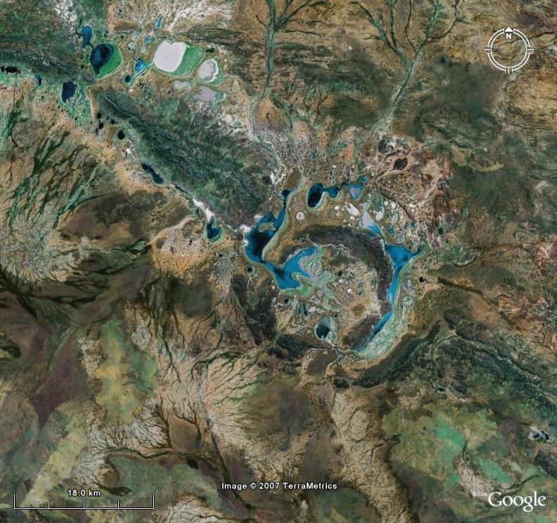
Where on (Google) Earth? #204


Nic, who does not yet have a blog, has asked me to post the following image for Where on (Google) Earth number 204. I'm going to assume the Schott rule is in effect, unless Nic says otherwise. So wait the allotted time, and go hunting. Post location and geology as soon as you surmise them.

Friday, May 07, 2010

Where on (Google) Earth #203


I'll be honest: I don't know a thing about this place. Back when WoGE was young and I was competative about it, I teed up a whole bunch of potential spots to use so that I wouldn't have to waste time looking for a new spot. I thought this looked neat, so saved the picture. I did not write down the location. So get cracking folks, and if you know what creates this bizarre landform, please tell the rest of us. Schott rule is in effect, and winners list is at:
http://ron.outcrop.org/kml/WoGE.kmz

Saturday, March 08, 2008

Where on (Google) Earth? #117

This time, I've pulled a new trick out of my hat. I have altered the color balance of the image, so that you can't just scan the continents at a wide zoom looking for something that has the right average tone.

Y'all will have to do some geologizing instead. And if any of the sedimentologists can explain how this sort of drainage pattern evolves, I'd love to know.


Schott Rule is in effect: Wait one hour per win before posting. The winners list is in the WoGE kmz file.

Saturday, January 19, 2008

A planet full of WoGE


In celebration of the first anniversary of Where on (Google) Earth, I decided to have a quick look at the locations the geoblogospheroids have chosen for this highly successful quiz meme.

Below is a pie chart of the area of continents and major islands.

Compare this to the distribution of WoGE sites:

As you can see, Asia and Africa are under-represented, Antarctica is badly under-represented, while North America, Europe, and small islands are over-represented.

But there is more to geology than surface area. Below is the breakdown by tectonic regime (using the USGS plate boundary kmz file):

While “craton” here incorrectly includes the deforming interiors of several continents (Asia, Africa, North America), I’m still surprised that more sites weren’t close to active margins.

Wednesday, January 02, 2008

Where on (Google) Earth #84


The following picture illustrates a tectonically-controlled climactic process. Name that process along with the location. The Schott Rule is in effect. Obviously, a picture with this much cloud in it is going to go wonky in an oblique view, so we will use the traditional approach.

Friday, September 14, 2007

Where on (Google) Earth? #47

Browsing through past Wo(G)E entries, it occurred to me that the most ubiquitous geomorphologic feature in the entire solar system had not yet been displayed. So here you go. The lat and lon are insufficient to win this contest; I want the name of the feature as well.

Sunday, July 22, 2007

Where on (Google) Earth? #37


This has to be the easiest woge since the LGM ice caps slid into the sea. While the Schott Rule still applies (one hour per previous win), people waiting for the clock are welcome to name as many glacial features as they can make out in the picture.

Kent got it last night, bit I'll put up Yami's clues anyway, since they are interesting.

Oblique Google Earth view, looking south from small western plateau:

Actual view from same location:

Sunday, July 15, 2007

Where on (Google) Earth? #33

There's nothing like winding down after a field posting by knocking off a woge as a distraction from trying to find a route that doesn't bog the truck so much. So for everyone back on break, here's another picture of our beautiful planet. The geological theme for this episode is structurally controlled drainage. The environmental theme is clearcutting.


In order to open the contest up a bit, I will ask previous winners to wait 24 hours before answering.

Thursday, June 21, 2007

Where on (Google) Earth #18


Sagan has no blog, so I'll post 18. Next one is somebody else, though. No hints. Please also list the order in which the various features cross-cut.

Wednesday, June 20, 2007

Where on (Google) Earth? #17

This one might look a bit intimidating at first, but applying geologic principles instead of pattern recognition should make it easier than it appears.


A world geologic map might help too.

If former winners could give the public a 24 hour head start, that would be great. As always, an explanation of the method used and the geology featured is a welcome bonus. And everyone is welcome to talk to each other in comments to get on the right track.

Original Where on (Google) Earth series here.

Tuesday, June 19, 2007

SPOILERS for Where on (Google) Earth #16

The original post is here.

If you are still working on it, stop reading now.

I recommend going to Ron's site, and having a go yourself before reading the spoilers.

If you know geology, it is actually fairly easy to deduce where the answer has to be.

Go ahead. Have a look.

I will talk you guys through the process below.

My first gut feeling was the Tarim Basin, but before running off to Asia, I decided to look at the pic analytically.

Ron's fatal mistake was adding the oblique view. While this looks mostly like a gimmick, it gave crucial information- namely the presence of snow-capped mountains to the East of the view area.

Also, there are no folded strata visible. Finally, the mountain looks like an eroded volcano. The obvious place to look for arid volcanic landscapes with higher mountains to the East is the Atacama desert. So, I started around 24 deg south, and worked my way up the coast into southern Peru, where the shore starts getting much less arid.

I had no joy, but I was confident in my reasoning, so I came back down along the dividing range, and look what I found...


22o54'S 67o13' West

I have no idea what the groundwater eroding ash canyons are called, but the meandering thing is a river.

Sunday, June 17, 2007

Where on (Google)Earth #15?

Brian has kindly offerend to share the joy of his "Where on Google Earth?" series, so I figured I would step up to the plate. This entrant is dedicated to billabongs*:


Veterans of the series will note that I added a scale bar. I did so for three reasons:
1. It is good practice.
2. It will hopefully level the playing field for mortals against GoogleEarth gods like Ron, who can asertain the scale through diabolical means.
3. It might even help the educational value of these pictures, by giving people a feel for the size of the features shown.

* Known to Americans as ox-bow lakes